How Germany’s borders have changed over the course of the 20th century.

Context:
Germany did not unite into a nation state until much later (1871) than many of its European neighbors. Germans for centuries had settled across much of central and eastern Europe establishing communities in neighboring Poland and Bohemia (present day Czechia) and as far east as the Ukraine and the Baltic states.

Context:
Following WWI the German Empire and its monarchy were dismantled and disposed. Territories were lost to France and Poland in Europe that had significant communities of German people. Poland was given a corridor to the sea and the city of Danzig (Today known as Gdansk) was made a free city by the League of Nations due to its mixed population of German and Polish citizens.
Context:
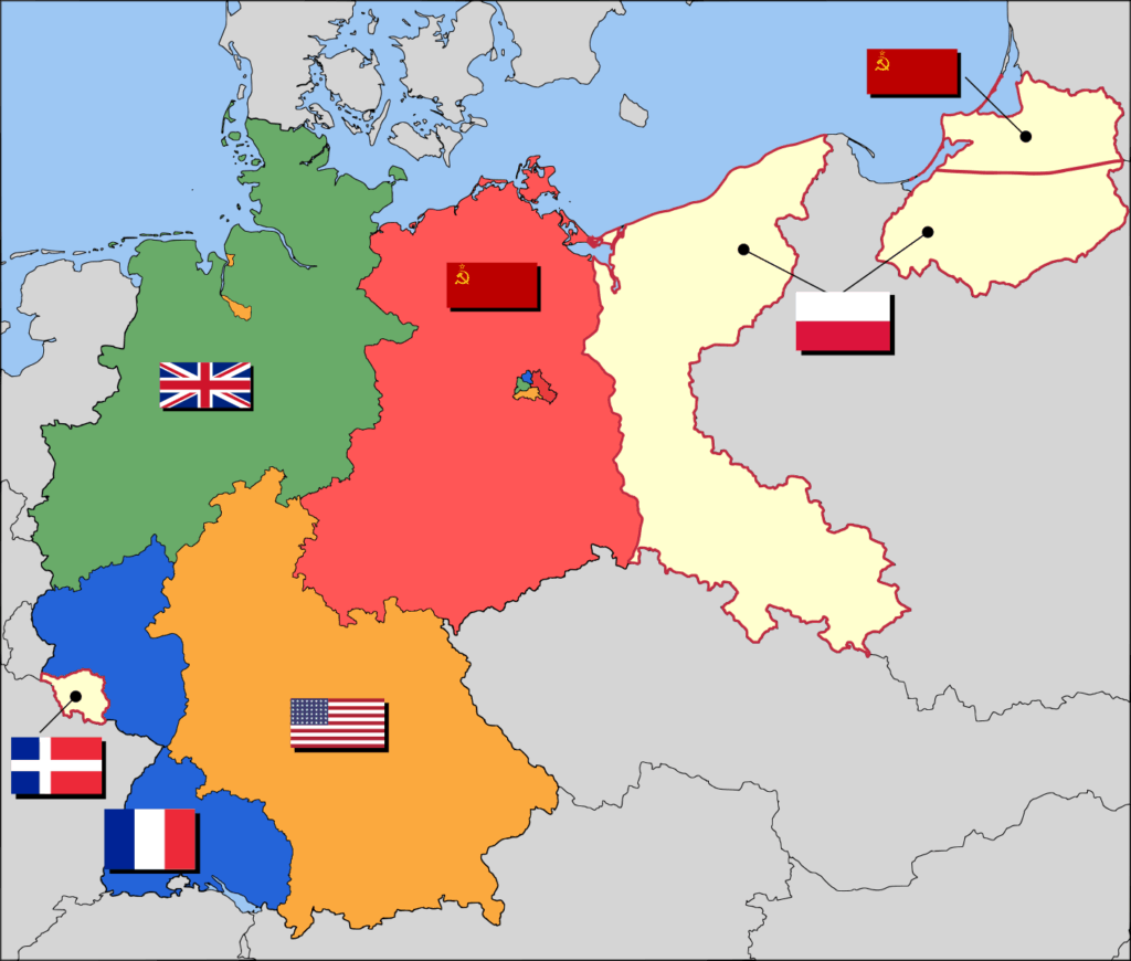
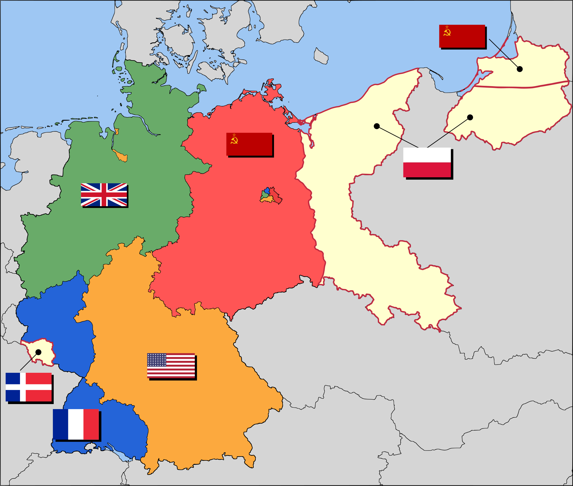
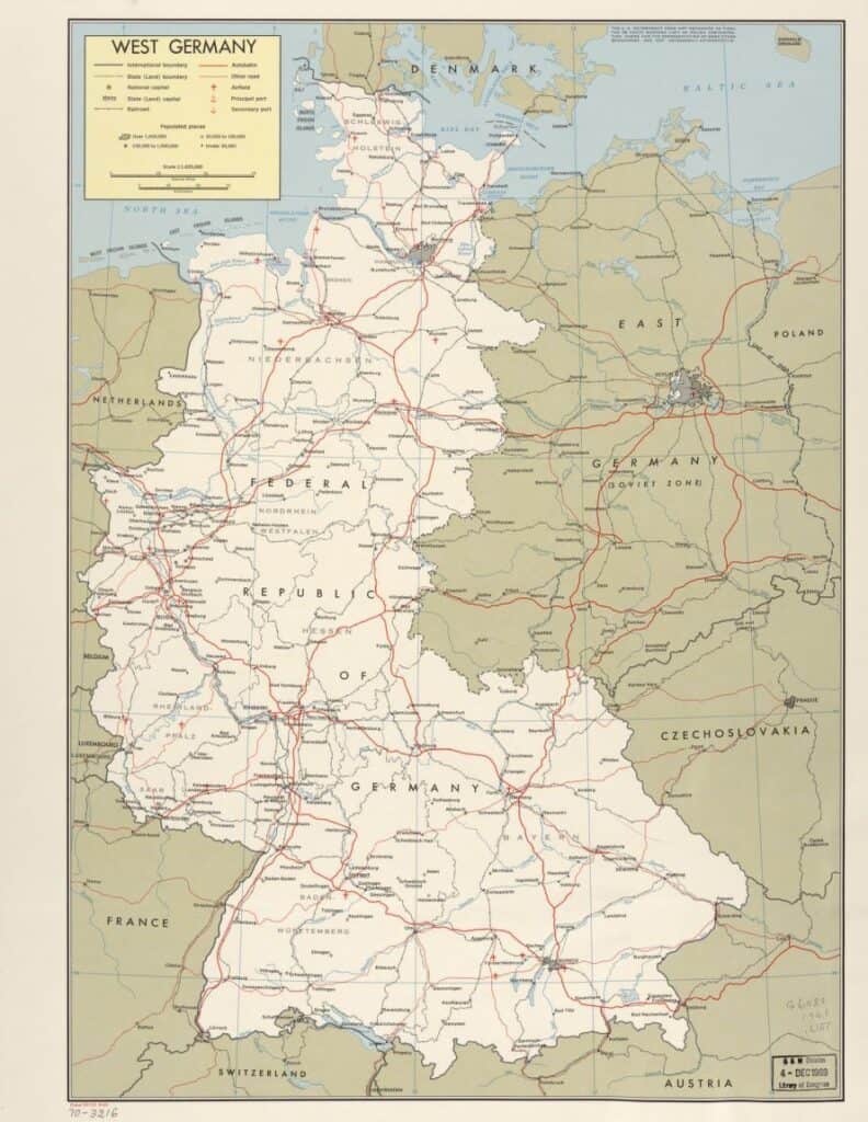
Following WWII Germany lost its ability to manage its own affairs. In the west Britain, France, and the United States were the occupiers; while the state of Saarland, under French pressure and influence became an independent territory. In the East the Soviet Union became the main occupation force. Due to Soviets taking large portions of Polish territory in the east, much of what was eastern Germany, those areas East of the Oder River, was awared to Poland. The heart of the former German state of Prussia became an exclave of the Russian SSR. Millions of Germans were expelled from these areas and they were forced to move to the new German border.
Context:
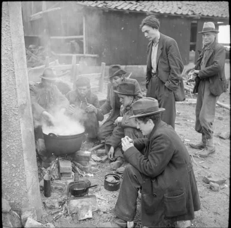
Millions of Germans were displaced due to both the destruction of cities and to the seizing of territory and the expulsion of ethnic Germans by the Soviet Union in the east.

Context:
Over the course of the 41 years that Germany was divided into East and West, millions of East Germans fled from their communist government into West Germany. Following the construction of the Inner German Border and the Berlin Wall these numbers were greatly reduced. Those that did manage to escape often chose the divided capital of Berlin as the city was a bastion of Western Democracy surrounded by the communist east. If refugees could make it into West Berlin they could then be moved into Western Germany proper.

Context:
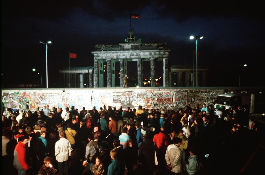
Due to years of economic stagnation and political mismanagement East Germany began to quickly crumble in 1989. A loosening of restrictions of the East German government sparked a series of events that would lead to the free movement of citizens both within the country and more importantly into the West. The Berlin Wall would eventually be opened and then torn down, becoming the precursor to reunification of East and West in 1990.
Questions:
- Why did Germany undergo so many changes during the 20th century?
- How does the first map depicting the locations of ethnic groups impact your understanding of the territorial changes that Germany experienced?
- Why was Germany divided following WWII? Who were the main architects of the division of Germany? What do you think happened to ethnic Germans living in areas outside of the new borders?
- Germany was divided into East and West for 41 years, what changes might have occurred in these two different areas during this time?
- Do you think reunified Germany experienced or may still be experiencing any issues from its earlier division? What might they be?
Bruce, your post reminds us how new the concept of nation-state is in the course of human history. The post effectively uses a series of maps and related images to chart the shifting boundaries of the modern German state. Your scaffolding questions effectively guide the student to a deeper understanding.
If you look at the original assignment, you’ll see that this post sort of strikes out in its own direction. While it does not specifically follow the assigned task, it does a great job of exploring the role of place in the modern German experience.