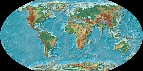
Picture: Winkel Tripel Projection (Winkel III), Kevin Gill https://www.flickr.com/photos/kevinmgill/6326120708
Lesson Study I
- Intro– 9th grade World History course, 1 class
- Content – Students will be able to identify various map projections (Mercator, equal-area, equidistant, and Gnomic) and explain when and why each are used. Beaverton SD target: I can demonstrate the ability to use geographic tools
- Process – Map Projections Lesson
*Previous lesson- discussed the definition of geography and the 5 themes of geography
- Quick Write: How does geography shape the way you see the world? (10 minutes total)
- Students will answer question in their notebooks
- Share their ideas with a partner
- Share ideas with the class
- The teacher will give each table group of 4 various map projections (Mercator, equal-area, equidistant, and Gnomic) (15 minutes)
- Students will complete a chart describing what they notice about each projection and questions they have (notice/wonder chart)
- Why would each be used? When would it be beneficial to display the map in that way?
- Can they identify the name of the projection?
- Each group will share their findings with the class (10-15 minutes)
- Lecture on map projections. Provide note taking sheet for students to organize the information– Kahoots quizzes throughout to check students understanding of the material covered in the lecture (20 minutes)
- In same groups, discuss when and why each projection would be used (5 minutes)
- Share out (10 minutes)
4. Product – They will complete a notice/wonder chart when looking at various map projections at the beginning of class. This will provide a scaffolding mechanism for them to make meaning of the mystery projections they receive. The students will also complete a note taking sheet while listening to the lecture.
5. Evaluation – They will be informally assessed on their answers on the Kahoots quiz. It will not count for points, but it is a good indication to the teacher what students are retaining. The goal is also to help keep students engaged and eager to pay attention. Students will also be informally assessed by their group work regarding the map projections. The teacher will evaluate how well students understand the material when they share their findings with the class.
6. What kinds of thinking will students need to do to participate in the lesson? Higher Order Thinking- the mystery map projection activity allows students to discover the nuances of the map projections for themselves. They are analyzing and evaluating the projections and piecing together what they know and don’t know, in order to discover why each projection is used.
Lower Order Thinking- Students will recall information that they know about map projections already in order to explain when each projection would be used. They need to know what a map projection is and how it relates to geography.
- To what extent do students have options or choices regarding these lesson components? Students have the opportunity to choose which projections they would like to discuss and examine with their group. Each group will look at all of them, but students have the option to select which one they want to look at first.
Reflection
Collaboration is essential in the world of education. I thoroughly enjoy bouncing ideas off of fellow educators, students, and colleagues, especially in the beginning of my career. One of the most daunting aspects of student teaching to me is lesson creation. I want my students to be engaged and want to come to class. This requires very careful planning. I sometimes feel lost trying to figure out where to start. Therefore, I really appreciated having the opportunity to have my peers review my lesson and provide feedback.
At my placement, most of the units are designed collaboratively. Teachers are assigned to Professional Learning Communities (PLCs) based on the courses they are teaching. As a team, they create units, learning targets and goals. Each teacher has the ability to change the lessons to fit their style, but they all use the same materials. I found this incredibly comforting. Everyone works together and shares ideas about how to best serve the students.
I like this lesson. Have you considered going back to the maps after the lecture and Kahoot? I think it might be nice for the students to interact more with the projections now that they have more information. It might able be helpful for them to see these materials again and realize that what was recently unfamiliar now “makes sense.”
That is a great idea. It would tie the lesson together much nicer, if we came back to the projections after the Kahoots activity. Thank you!
Everybody loves a mystery! Have you seen this great resource at National Geographic? Investigating Map Projections. Some excellent activities and handouts. I like the ideas of peeling an orange and turning it into a flat map. Tactile plus you get a snack.
PS – don’t forget to add an image to the post.
Thank you for sending the link to the National Geographic site. I am going to send it to my CT. He was just talking about how we can create a meaning way for students to learn about map projections. There also is an excellent clip from the West Wing where they debate which map projection is best. Tons of great ideas for this topic!
PS.. oops… I just added a picture. Thanks for the reminder.
That’s awesome that the school your Student Teaching at has a Professional Learning Communities. Creating a school culture where collaboration, feedback, and a spaces that welcomes community is so important as educators. It takes a village to raise a child, so it’s fresh to see this being model. I also agree that this assignment gave us a unique chance to give feed to each other, and to see all the different ideas we’re planning to use in the classroom. My only question that came up is when you wrote in the content section that you wanted students to explain when and why different map projections are used. Will you show or explain to students on how they can personally use map projections in their life?