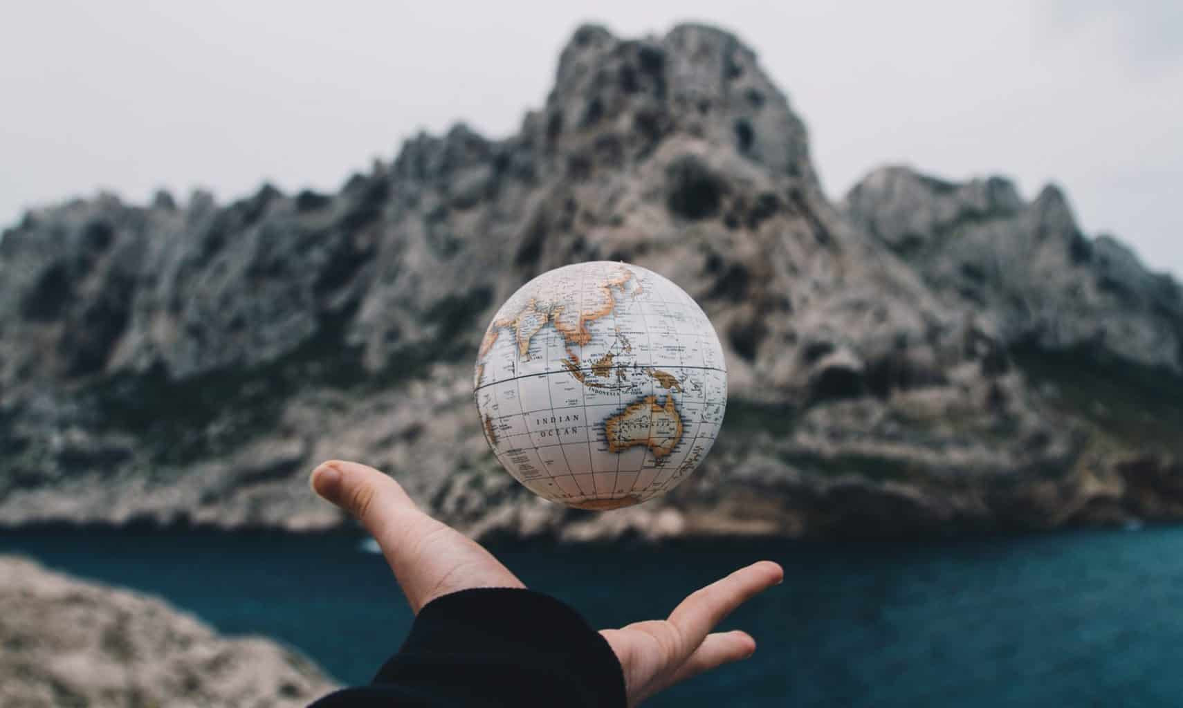
A while back a friend asked me what I would buy if I had 1 Million dollars. I couldn’t answer the question as asked. “I wouldn’t buy anything,” I replied, “I would travel.” For me, traveling is a way to discover new and fantastic landscapes, and immerse myself in the unknown in a way that I could never do behind a computer, or through a book. There are some things that simply cannot be learned without experiencing. The sights and smells of the souk in Marrakesh, the tangible openness of the Montana plains, and the imposing presence of the Edinburgh castle over the city in the evening are those things that require a personal connection.
This is why I also love maps. The opportunity to explore new places means the opportunity to discover just a bit through a map. What does the city think is important? What cultural institutions are presented first and foremost? What parts of a place feel hidden and secret? Where do I go to get the best food? All of these questions can start to be answered through maps.
Below I’ve presented two maps and two pictures of Barcelona, Spain, a city I have not been to, even though I’ve been to Spain a few times. I’ve always wanted to go, and looking at the maps below, now I have a renewed passion for visiting. I want to show these to you to better understand how the city has changed, and in some cases not changed at all, since the turn of the 20th century.
PART 1:
A map of Barcelona
The first map is dated around 1910, and the second is the Apple Maps view of the city today. Take a look at these pictures, and explore the city with me below.
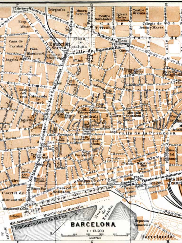
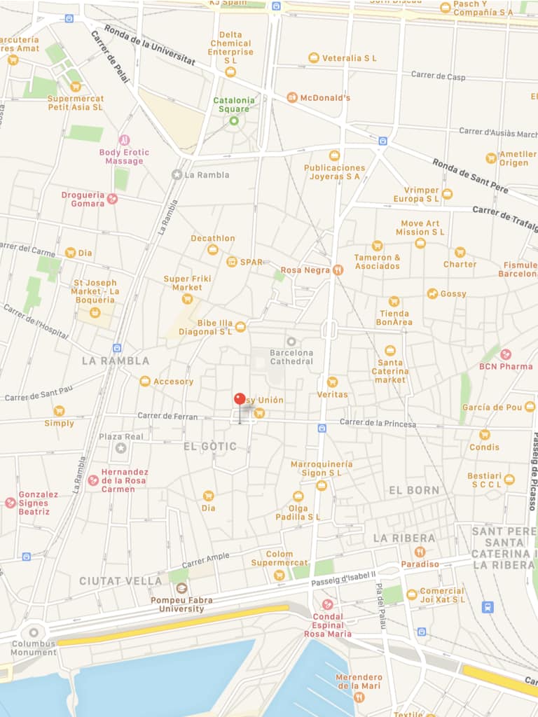
Some questions and thoughts regarding these maps
- What would you consider to be the “center” of Barcelona in either map? Would you think this has changed over time?
- How has city growth-and the advent of automobiles-changed the way Barcelona looks from 1910 to today?
- Based on the city layout, where would you start a “Barcelona Adventure”? What would you want to see in the old city, versus the new?
- If you’ve been to Barcelona, post a reply and let me know how these maps speak to your own adventure’s experience!
PART 2:
The Arc de Triomf
Barcelona hosted the World’s Fair in 1888, and built for it’s exposition the Arc de Triomf, a massive arch that acted as the ceremonial entrance to Ciutadella Park, where the exhibition was held. Built to model the recently completed (and more famous) Arc de Triomphe, Paris, this arch remains as a symbol of Barcelona’s worldly influence. The first image is of the arc in its debut at the 1888 World’s Fair. The second image is of the arc in 2015.
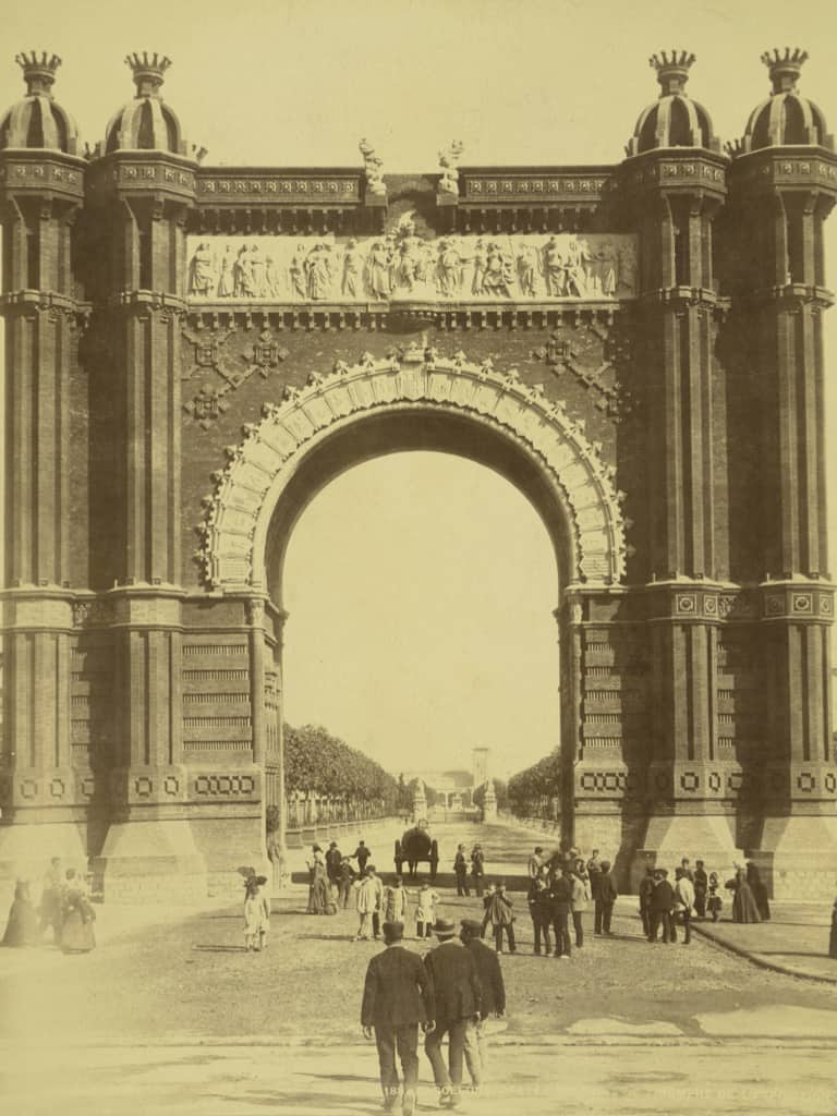
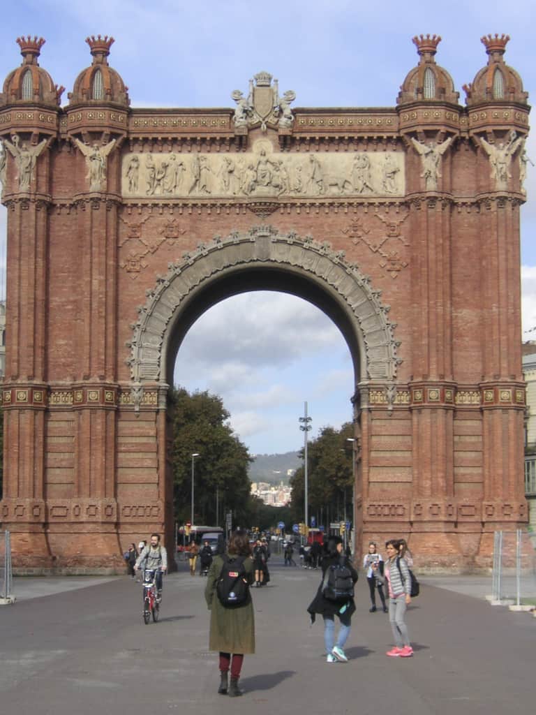
Some questions and thoughts regarding these pictures
- How do these two images compare at first glance? What’s been changed/added/removed?
- The Arc de Triomf was known as the “Gateway to Modern Barcelona”. Do monuments to modernity exist in contemporary society?
- What does the condition of the arch tell you about its significance to Barcelona, and Spain in general?
Thanks for sharing this! Interesting to see how the sculptures on the Arc de Triomf have actually changed. I wonder if that was just because they became worn over time, or if there was something controversial about it?
The modern Arc actually appears to be more ornate, which may be due to it’s increased importance for local or national pride. I’d be really interested to know when these updates were made.
Yeah I noticed that too. I get the impression that this park area has been updated a couple of times. So I wonder if they took that opportunity to also make some kind of update to the arch as well.
Hi Tyler! I really like how you put a personal touch on this post. Traveling really does open our minds and connect us to the past. Very interesting use of images! In the maps of Barcelona, I think it’s really fascinating that so much has changed, but there are still clear landmarks that persisted, like the Cathedral. This gives a clear look into what places are valued enough to stay put over the years. Great post!
Interesting way to explore the travel theme – both from a macro and micro point of view.
The map contrast is striking. Especially for the layout and design of each map. Of course the historic is in Spanish (or Catalan?). It is so much more detailed, but it sacrifices legibility. You can easily see where new roads have sprung up. Makes me wonder what got torn down to do that. And with our emerging “anti-car” ethos, I wonder if there are some regrets.
The arc compare is interesting for the persistence of architecture. Same spot. Same relationship with road beneath, but so much around it has changed. (I went back and looked at source images you used)
Great alignment on both sets. Though I wonder if the map compare shows a new “coastline?” Or if that’s just a scale thing.
I think the coastline thing is scale. I also noticed, that, as well as the “Calle de Princesa” being off as well. My guess is just that the older map isn’t as accurate to scale.
City design is definitely one of my favorite subjects. I used to live near DC and so walking through that city as compared to my hometown in Eastern Washington I could tell how it was made for people and not cars. I would be curious to know what cities have tried to accommodate new types of transportation, versus which ones have decided to maintain an automotiveless interior.
Maps are an amazing thing. I really like the photo comparison of Barcelona. What’s great is that you get to see the changes from 1910 to right now. What is still standing and what is missing? The small changes in the Arc de Triomf is something to behold. Yes, bottom line it is the same, but it is a whole new arch in the second photo.