In the classrooms I’m teaching in this year, I have 11th and 12th graders that are taking U.S. History. There are many ways to bring what my students are learning to life. My students respond better when their learning becomes a bit more interactive and they a making students responsible for their own learning in a new way.
I think it’d be really fun when we are learning about the Civil Rights Era to have students try and make their own trip off of the Green Book maps. Source The classrooms I am in have their own sets of Chromebooks that students are able to use, so this can be a classroom activity, since many of my students do not have access to computers at home.
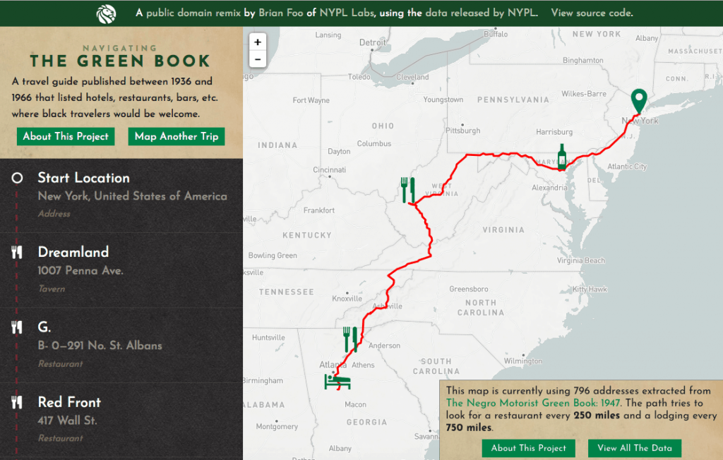
In this activity, I would ask students to get a chromebook from the back of our classroom and go to this website. Students would then pick a starting and end point. Students would have to note and 2 places to eat and at least one place to stay along their journey. This might be harder for shorter journeys because not a lot of places allowed black people to eat in their resturants or stay the night. After mapping their journey on the website, students would then have to write a letter to someone back home talking about their journey and the different places they ate and spent the night. They would also need to include some things they saw along the way that would remind them that they are in the 1930’s or 1940’s. These additions might include things like signs saying “whites only” or seeing Hoovervilles as they are traveling along. Students would also need to note how they are traveling from their different destinations, whether by foot or car, or another mode of transportation. This would be a really fun activity for students to be able to first visualize what a journey for a black person might look like prior to the Civil Rights era and also give them a space to synthesize what it was they had been learning about.
This is an activity that I think my students would enjoy and something I could see myself using in the classroom. I know when I’m trying to understand something that it helps to have a visual representation of what it is I’m studying. This helps me get a better idea of what life was like for certain people, better than just reading about it just hearing about it. When I have used interactive maps or other ways to visualize the past in my classroom, my students have responded pretty well to it. I think each of us would benefit from using these platforms to visualize the past.