Historical Thought in Remote Learning

Featured image source

One of my favorite things about studying history is learning how to dissect a source and understand what voices of the past have to tell us today. Approaching the start of my student teaching placement, I was concerned about I would have success engaging with students in an online format. I was unsure if my love of the subject would carry through and if students would be able to grasp the lessons, I hoped they would. While remote learning has certainly come with its own struggles, I am pleased with the progress I have made encouraging students to engage with primary source information and come to their own complex conclusions.

Over the summer of my MAT program, one of my instructors, Tom McKenna, showed us a lesson he had created for his students in 1983. As a teacher, Mr. McKenna sought to teach students at Grant High School about redlining and the racial history of Portland by asking his students to create a short film about South Portland. The film included photos, map, and interviews with residents of the now demolished South Portland neighborhood. Once home to Portland’s immigrant community, the film showed how urban renewal projects labeled parts of South Portland as ‘blighted neighborhoods,’ making way to the condos, Keller Auditorium, and other features the city hoped to construct in South Portland in the 1950s. In other terms, Mr. McKenna’s class did the work of real historians – discovering the past by tracking down primary and secondary source information and creating something new to contribute to the conversation around the history of urban renewal in Portland. As a history teacher, I seek to create lessons that can similarly extend beyond simply memorizing dates, names and facts. I want students to grapple with the tangible questions of history by creating and discovering the past in a way that transcends textbooks to build critical and historical thinking skills, persuasive speaking and writing, creativity, and a desire to learn.

This class gave me the flexibility to explore document-based lessons in a variety of approaches and technological considerations. Below, I’ve highlighted several lessons I created with the intention of building these skills.

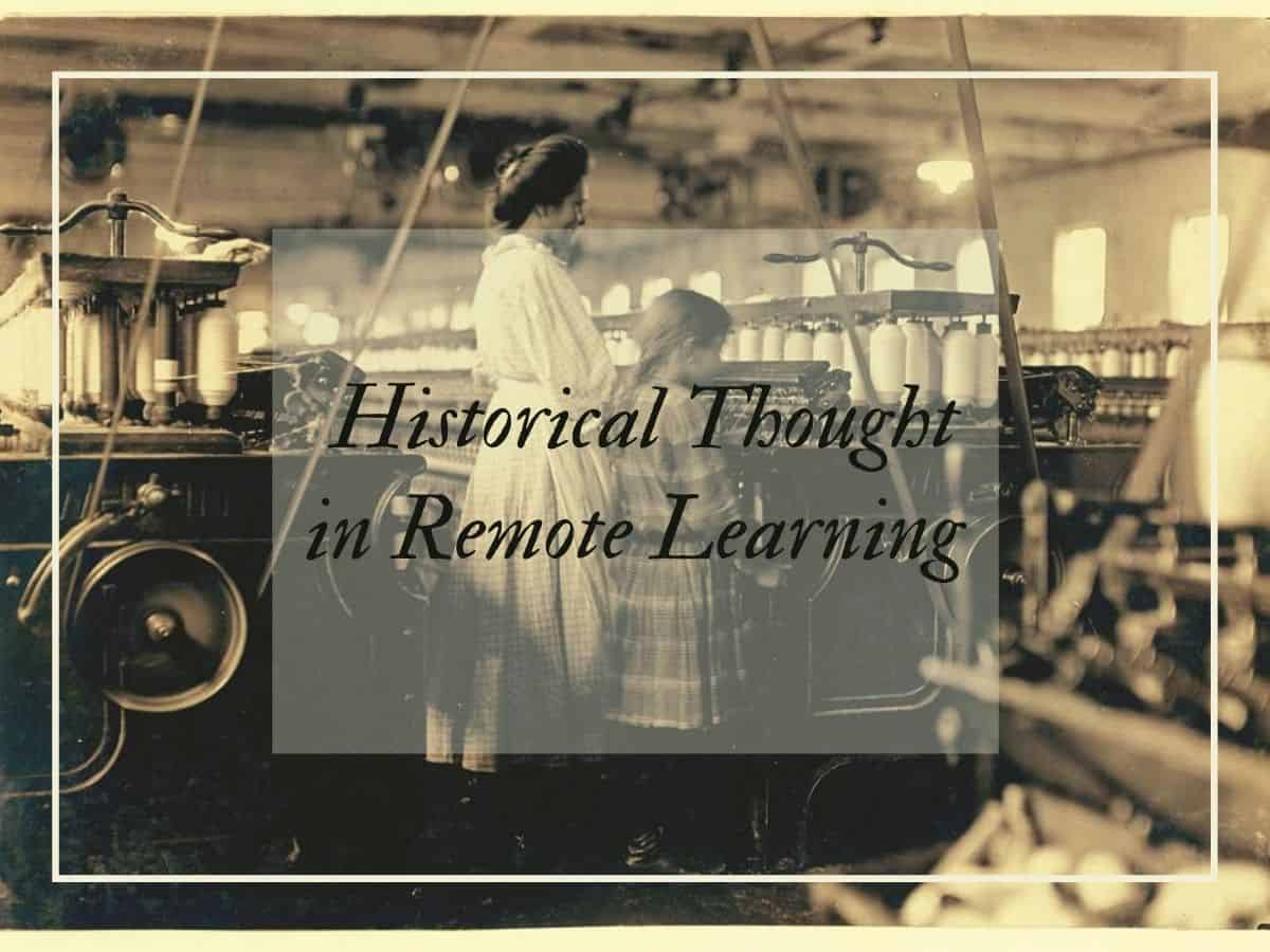
In this lesson, students will analyze a series of images related to the theme of organized labor struggles to build historical thinking by asking key questions about each document that are designed to scaffold students to increasingly complex levels of historical thought. By asking and responding to these questions, students will gain a greater understanding of labor rights struggles and an appreciation for multiple points of view on related issues such as racism in the workplace, and source bias.

This lesson could serve as an introduction to labor rights struggles that accompanied the Gilded Age. Students would use critical thinking to analyze image primary sources as a way to prepare for analyzing the era in greater detail.

This lesson is the basis of the first lesson that I taught in my student teaching placement. Renaissance Italy was one of my primary focus areas as an undergraduate, and as soon as I discovered that my CT was preparing material to teach about the Black Plague, I was immediately excited to jump right in. Along with my PLC’s co-student teacher, Maggie, I created two lessons that asked students to explore primary sources from the era of the Black Plague to understand this time period and draw parallels to the COVID-19 pandemic.

The first lesson included several written and image primary source documents along with sourcing questions that were selected to encourage students to consider the meaning of the source and their authors potential biases and points of view.

The second lesson asked students to draw parallels to the modern-day, including by comparing the uniform of plague doctors to that of a doctor treating COVID-19 patients and analyzing medieval thought to how diseases spread through artwork with modern government infographics. Lastly, this lesson included an opportunity for self-reflection by allowing students to describe ways that COVID-19 had affected them personally.

This mini lesson was designed as a potential companion to a social studies class conversation about the history of freedom of speech by introducing students to a time in which free speech was restricted during WWI. This lesson could be either a part of a government class, or a U.S. history class in a larger unit on WWI. Engaging in this lesson as a larger part of WWI also has the potential to allow students to see beyond the combat of the war itself to understand the consequences that the reality of the war had in the U.S.

This lesson includes a Google Form with an embedded version of former presidential candidate and labor rights activist, Eugene Debs, famous ‘Canton Speech,’ in which he decried the U.S. government’s involvement in WWI. After listening to the speech, students in this lesson will read an excerpt from a newspaper article describing how Debs was arrested for ‘disloyalty’ for giving this speech and asked to respond to questions that gauge students factual understanding of the speech and newspaper article and asks for them to provide their opinion on the legal and ethical question of if Debs’ arrest was justifiable and if freedom of speech should ever be restricted.

This lesson encourages students to understand the contest of the era and leads into a larger political debate that is applicable both to our past and the present. One way to expand on this mini-lesson could be by breaking students into two groups to debate Debs case, and whether the U.S. government was justified in arresting political dissidents for speaking out against the war.

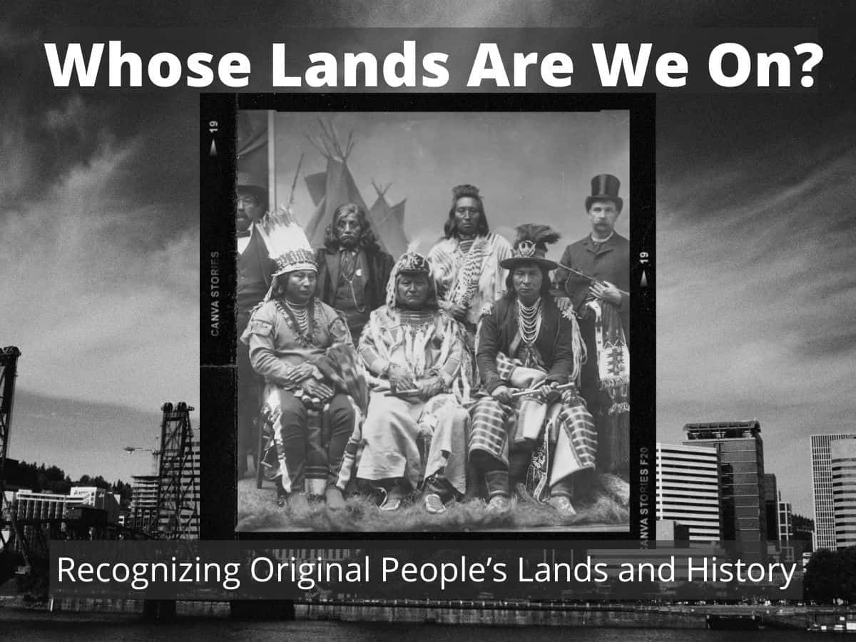
My final project for this class, and one of the lessons I am most proud of, this lesson guides students through an exercise in indigenous land recognition. Land recognition is a concept which I only became familiar with in the last few years, however, I believe this simple act of recognizing the indigenous groups that still struggle with the effects of settler-colonialism is highly important. I believe this lesson could work as part of a unit on the concept of westward expansion to recognize the indigenous groups, whose struggles are often left out of the school textbooks and School House Rock videos on this topic. Additionally, this lesson could fit in with a unit on indigenous history for students to learn about the original people who inhabited the Pacific Northwest and build students empathy towards their historical marginalization.

In this lesson, students will be introduced to the concept of land recognition and its importance by viewing two videos about the importance of honoring native land. The intention of these videos is to start a class conversation which would gauge student’s thoughts on why it is important to acknowledge the original people of the land and what we can do to examine the impact of our presence on native lands.

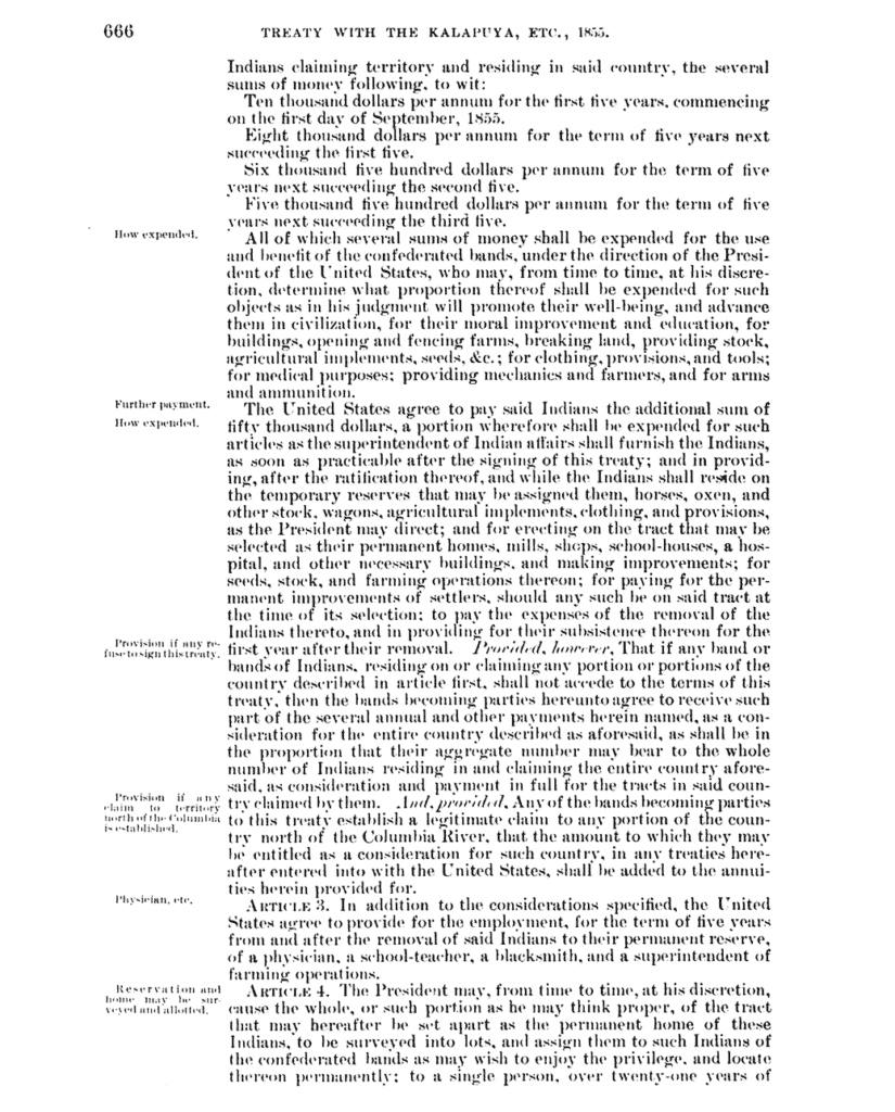
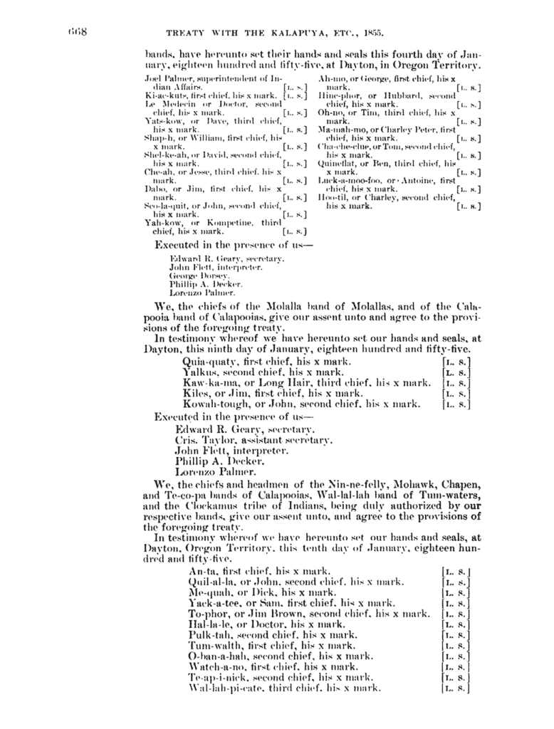
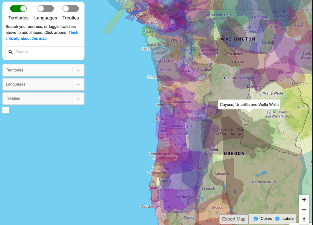
Further, students will analyze two maps that show U.S. settler expansion and which lands are technically ‘unceded.’ This map also allows students to learn about the names and dates of different treaties involved in the U.S. government taking indigenous lands. The lesson includes sourcing questions for students to read and analyze the Treaty with Kalapuya, which ceded lands of much of present-day Oregon to the United States.

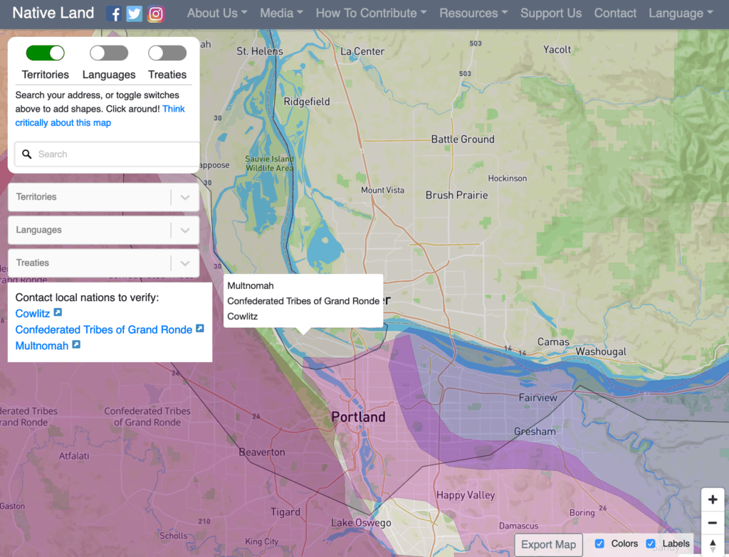
Lastly, students will use a second map to identify and learn about the original people of the Pacific Northwest, including where they lived and the languages, they spoke to create their own land acknowledgements.

I believe this lesson could be expanded on to encourage the school to create its own land acknowledgment or engage students in meaningful indigenous activism, such as a clothing, supply, or PPE drive for indigenous communities fighting COVID-19.

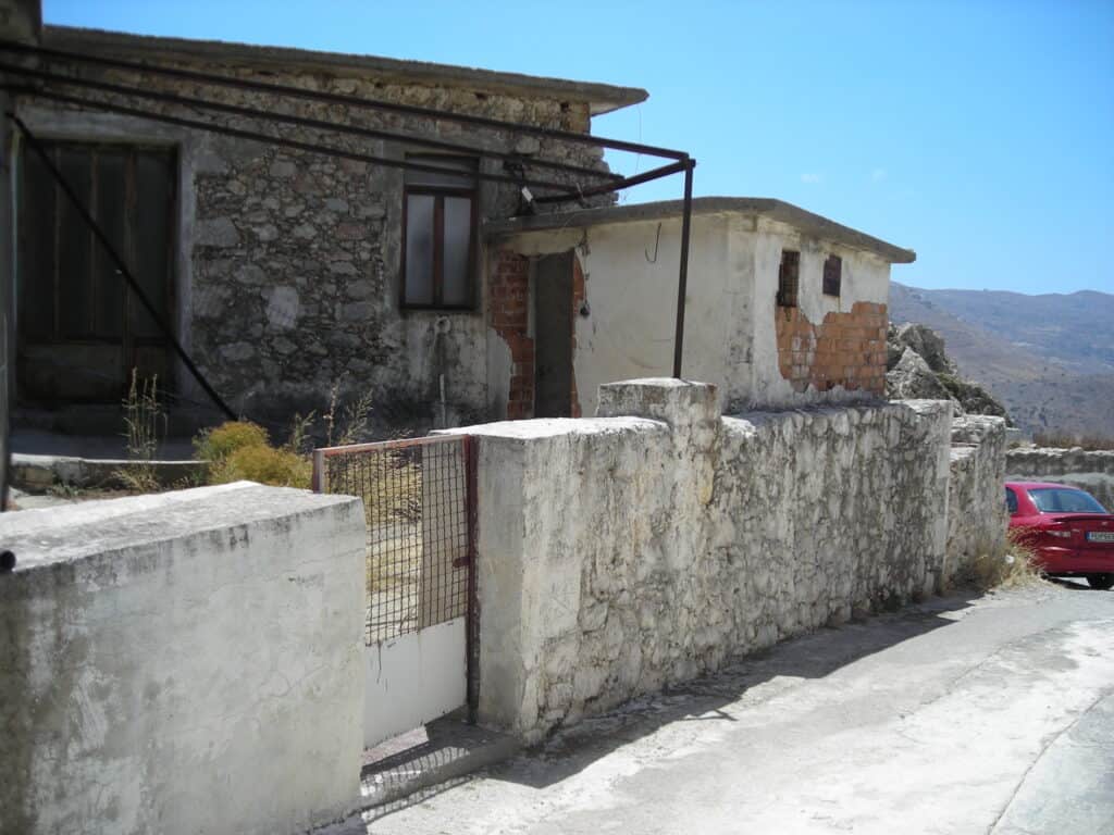
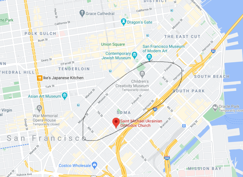
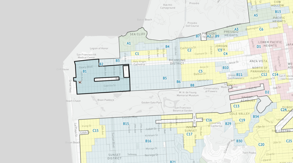
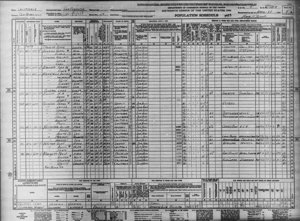
The final post I wish to highlight in this portfolio takes a more personal approach than the others highlighted above, however, I believe it could be adapted into a meaningful lesson on immigration, redlining, and personal history. We examined HOLC redlining maps and census data to analyze housing practices and learn about life in the 1940s. I chose to use this as an opportunity to explore my personal family history by finding my family in the census and writing about the historic Greek Neighborhood that existed in San Francisco in the early 1900s. This was an excellent project for me to learn about the importance of ‘place’ as a historic and geographic concept.

I believe students would benefit from an adapted version of this project, which either encourages them to explore their own family history or the history of where they live. I believe an adaptation of this project could benefit students by connecting historic concepts they’ve learned about with themselves, and see how history affects them and their families more personally. This lesson could also serve as an introduction to housing segregation practices, and the concept of redlining, Portland’s Vanport and Albina neighborhoods, and urban renewal, more broadly.

Whose lands are we on? Recognizing Original People’s lands and history

Featured Source Image *
Source background photographed by me

Instructional Goals:
The purpose of this lesson is for students to identify local indigenous tribes and evaluate how those groups were impacted by U.S. westward expansion. Students will be able to use the Native Land map to identify indigenous groups in different regions of the Pacific Northwest and create a land recognition book using Book Creator that recognizes indigenous territories, languages, treaties, and the impact of those treaties today.

Intended Grade and Background:
When I started studying history at the college level, one of my biggest realizations was just how much of the history I had learned in K-12 had been thoroughly white-washed. Despite the fact that I grew up among the towering redwoods that the Awaswas Ohlone people historically called home, this chapter of history was largely omitted from my education. Instead, my most significant memory of learning local indigenous history was in the form of building ‘Mission Projects,’ models of the Spanish missions that lined California, without much attention given to the sinister purpose these missions served. Today, I know that the primary goal of the scenic missions in California was the hegemonic destruction of indigenous culture and enslavement of local indigenous peoples. Much like the example of the mission projects, indigenous history is not given nearly enough emphasis in U.S. history classes. As we learn about concepts like ‘manifest destiny’ and ‘westward expansion,’ we should give consideration to the real-world consequences these concepts had on the diverse indigenous groups who already lived in these regions.

In theory, this lesson would be part of a broader unit on North American indigenous tribes and groups, and would likely come near the end of the unit as an end-of-unit project. This unit would likely take place as a fulfillment of Oregon Senate Bill 13 to introduce individual place-based curriculum in K-12 public school curriculum. This unit could take place as part of a U.S. history class in early high school. Alternatively this lesson and unit could take place as part of a unit on indigenous government and Native American law in a government class. The Oregon Department of Education website contains a variety of lesson plans that fit into this context that are available to teachers to pull from. I could also see this as a useful geography lesson, especially by teaching students the names of geographic locations in the context of different indigenous languages. This lesson would likely occur over 2-3 days.

This lesson will introduce students to the idea of land acknowledgments to increase the class’s awareness of indigenous people and land rights in the Pacific Northwest. To accomplish this, the land acknowledgment activity below will use the Native Land map and ideas from the Native Land education guide to identify and recognize indigenous lands.

Essential Questions:
1. Why is it important to recognize indigenous lands?
2. What defines ‘place’ and who gets to decide what places are called on a map?
3. How does looking at indigenous maps make us rethink U.S. expansion and colonization?
4. What does it mean to say we are “on native land?”
5. How else can we validate indigenous people and lands?

SWBAT: During this lesson, students will create a land recognition book by looking at the Native Land map and treaty primary source documents. Students will identify the tribes that historically lived in locations in the Pacific Northwest and recognize those tribes’ lands, language and the impact treaties had on them. Students will be able to locate and display local indigenous geography.

The historical thinking skills that students will be working on include contextualization of primary source documents, recognizing how past events effect today, recognizing that documents are products of particular points in time, and establishing probable relationships by comparing different documents. The social-emotional skills that students will work on include empathy, awareness and understanding towards historically marginalized populations.

Instructional Materials

What is a land acknowledgement?

To work through this activity, students will first need to understand what original land acknowledgment is. To achieve this, students will first watch a video about the importance of honoring native land. By viewing this video, students will be able to understand what land acknowledgment is. This will lead to a class discussion leading towards the following sourcing questions: (1) What is land acknowledgment? (2) What claims do people interviewed in the video make? (3) Why was this video created? (4) Why do individuals interviewed in the video claim land recognition is important?

HonorNativeLand – U.S. Departments of Arts and Culture

What does original land acknowledgement look like?

Having watched the previous video describing the importance of land acknowledgment, students will now view two different land acknowledgments and discuss what they see in both of them.

LJIST Acknowledgement of Original Peoples with Shilo George

Scaffolding questions: (1) Why does the video claim it is important to acknowledge the original people of the land? (2) What tribes does the video state originally lived in the area that is now Portland? (3) How does this document agree with the previous video? (4) Beyond acknowledging the land itself, what other ways does the video suggest we should examine ourselves and our presence on native lands?

Portland State University’s Land Acknowledgement

“Portland State University is located in the heart of downtown Portland, Oregon in Multnomah County. We honor the Indigenous people whose traditional and ancestral homelands we stand on, the Multnomah, Kathlamet, Clackamas, Tumwater, Watlala bands of the Chinook, the Tualatin Kalapuya and many other indigenous nations of the Columbia River. It is important to acknowledge the ancestors of this place and to recognize that we are here because of the sacrifices forced upon them. In remembering these communities, we honor their legacy, their lives, and their descendants.”

Scaffolding questions: (1) Why was this document written? (2) What elements of land acknowledgment discussed in the prior videos do you see here? (3) What groups does Portland State University’s land acknowledgment state traditionally lived in the Portland area?

Invasion of America Map

To understand how the U.S. committed genocide and stole indigenous lands, students will view the Invasion of America map, which shows a time-lapse of lands that were taken from indigenous people and incorporated into the United States between 1776 and 1887. The map includes several useful resources, including a legend, which importantly states which lands are current reservations, which lands were indigenous lands, and which territories are technically ‘unceded.’ Additionally, this map allows students to click on different regions to see the dates and treaties related to these lands.

Scaffolding questions: (1) What do you notice about map time-lapse? (2) What are the grey areas on the map? *hint, click the legend button to the left of the icon with the 4 squares (3) What does ‘unceded’ mean? (4) Review how we discuss the legacy of westward expansion and manifest destiny. How did these concepts affect indigenous peoples?

Treaty with the Kalapuya, ETC., 1855

Having viewed the Invasion of America map, students will identify the Portland region on the map and click on it to learn more about Cession 352: the Treaty with the Kalapuya and confederated bands of the Willamette Valley. Students will take the treaty home to read about its terms before answering the sourcing questions below in the next class.

Document source

Sourcing questions: (1) Who wrote this document, why was this document written? (2) What regions does this treaty claim belong to the United States (hint – see Article 1) (3) How much did the United States pay these tribes for the land taken in this treaty? (hint – see Article 2) (4) What is the purpose of Article 8? (5) What does this treaty say about the level of agency the tribe has over its own lands? (6) Which of the articles do you believe is most important/consequential?

Native Land maps

The next portion of this activity will allow us to learn more about the individual tribes that lived in what is now the Portland area. For this activity, students will be broken into breakout groups, and asked to use the maps to identify the tribes, languages and treaties of the following regions of the Pacific Northwest: Portland, Oregon, Vancouver, Washington, Seattle, Washington, and Bend, Oregon. Students will use the Native Lands map tools to navigate between each of these questions and find information for at least three of the tribal groups local to that area.

Slideshow source

Scaffolding questions: (1) What tribes and languages are originally from the region you were assigned. (2) What treaties are associated with these lands? (3) What does it mean to say someone is native to this land? (4) Who gets to name these lands? Can you find any indigenous names of locations using the map?

Instructional Tools and Activity

Having now researched land acknowledgments and indigenous groups originating from different regions of the Pacific Northwest, students will now create their own land acknowledgment using Book Creator or Google Slides. As a class, each group will collaborate to create a land acknowledgment page for each region. The land acknowledgment will include each of the following aspects: the names of at least three groups that lived in this area, the language they spoke, and recognition of why it is important to acknowledge this. An example of what one of the pages would look like can be found below.

Source, Background image photographed by me

Scaffolding questions: (1) Are there any names of places near the cities you wrote land-acknowledgements for that use indigenous names? (2) What defines a place (history, people who live there, geography), (3) Who gets to decide what places are called on a map? (4) Assess how completing this activity either has or has not changed how you think about topics like westward expansion and U.S. colonization. (5) Having completed this project, what does it mean to say we live on native land? (6) Beyond acknowledging lands, how else can we validate and uplift indigenous people and their lands?

Instructional Recommendations

As stated above, I think this lesson or series of lessons would work as part of a unit on indigenous history, or as part of a unit on geography or government. Activities described above may have to be scaffolded up or down depending on the age group engaging in the lesson. If possible, I believe it could be valuable to incorporate this lesson into larger action outside of school. This could include petitioning the school to practice a formal land acknowledgment before events, fundraising for indigenous organizations and causes (such as a warm clothing or supply drive for water protectors, or a PPE drive for indigenous communities fighting COVID-19), or conducting further in-depth research of local indigenous communities and their languages.

Some potential scaffolds and curriculum suggestions include:

  1. Allow time for reading long documents/paraphrase the treaty document: Combined with the other video activities, the treaty represents a complicated and lengthy read. For some classes and communities, it may make sense to paraphrase key portions of the treaty for reduced language demands.
  2. Allow students to branch out and create land acknowledgments for places they are from if they moved from somewhere else. Depending on where you are teaching this lesson, it may be a good idea to select different locations for students to research in groups to allow students to have better familiarity and connection with the topic.
  3. Maintain smaller groups of 3 or 4 students for breakout groups.
  4. Continue to connect back to this information in later lessons. When teaching topics like manifest destiny to ensure that indigenous people are not removed from historical narratives. Encourage students to recognize and reflect on how their presence and actions are reflective of their culture and the history of settler-colonialism. Encourage students to recognize and reflect on the space and resources they take up.
  5. Encourage students to research indigenous organizations and tribes to learn the proper pronunciation of names.

Continued learning

Outside of recognizing the original people of the land, I would close this lesson by asking students to research additional resources to continue learning about, recognize, and validate indigenous people and land, including supporting indigenous organizations, joining protests, or other forms of advocacy.

Additional listening: NPR This American Life: Act One Trail of Tears

* Photo of the members of the Umatilla Tribe. The Cowlitz tribe would have been the tribe that lived in the Portland area, however, I did not find photos of this group in the public domain

Rooted in History: Finding Family History in the 1940 census

Background:

The story goes a little something like this. Sometime in the late 1800’s a young Greek merchant, named Demetrius Vavourakis, from the small village of Kria Vrisi (Κρύα Βρύση), Crete met Alouisa Kopp, an accomplished violinist in a traveling orchestra in Athens. The two fell in love and became married. However, all was not well. The mixed Greeco-Austrian, Orthodox-Catholic marriage saw both Demetrius and Alouisa become estranged from both their cultures and they sought to start somewhere new. Demetrius sold his ships and along with Alousia moved to the U.S. in 1904, before relocating to the foggy shores of San Francisco. Demetrius Vavourakis changed his name to James Nicholas Vavuris, and he and Alouisa raised their family of 10, the youngest being my grandfather, Paul. (To my aunties who may see this post, my apologies if I have misrepresented family history!)

Village of Kria Vrisi (credit to me and my very very good early 2000s point and shoot digital camera)

As soon as I started looking at the HOLC maps and 1940s census data, I was interested in investigating family history. I knew that my grandfather and his siblings lived in San Francisco in 1940. Just a few years after the census, he and two of his siblings would ship out to fight in World War II and my great grandfather would pass away just months before the end of the war. I assumed that my family would have resided in San Francisco’s Greektown neighborhood, which according to the San Francisco Chronicle, was located in the working-class South of Market Street area, around Third and Folsom street. Greektown is actually not identified on the HOLC Mapping Inequality map, however, I imagine it would be classified similarly to D11, nicknamed “Little Europe.” According to the HOLC files, this district is composed of approximately 130 blocks and inhabited by second-generation immigrants from Italy and parts of Europe, who worked as laborers, factory workers, and service employees. A standard 6 room home in this region cost $3750 in 1940, and would have rented for $37.50 a month.

A very rough outline of Greektown, centered around St. Michael Ukrainian Orthodox Church

Like many immigrant communities, The Greek enclave in San Francisco was formed by the necessity of recent Greek immigrants to rely on each other, particularly after the 1906 San Francisco earthquake and fire, which resulted in a large number of jobs for rebuilding the city. The San Francisco Chronicle article notes that around 1930, roughly 5,922 Greeks lived in the city, however, by around 1945, many of the Greek residents of San Francisco had begun to move into the middle class and relocate away from Greektown.

Vavuris Family in San Francisco

After talking to my dad, I learned that my family actually lived on 47th Ave in San Francisco, near Golden Gate Park, Sutro Heights Park, and a former boardwalk amusement park, known as Playland, where my great grandfather ran a concessions stand.

Playland in San Francisco: Source – Wikimedia Commons

The 47th ave house is located in San Francisco’s B1 neighborhood. I found it interesting to see how the majority of San Francisco’s declining and redline neighborhoods lay in the city’s interior, near ports and dockyards, where many may have worked. By contrast, the B1 neighborhood is as far from the city center as one could be on the peninsula. The HOLC description for the neighborhood notes that it is a residential neighborhood inhabited by medium income group professionals and “white collar” workers, with “no threat of undesirable racial influences.” Homes in this area cost $4,000-$7,000 or rented for $65 a month. The HOLC designation notes that some parts of the neighborhood could be classified as “high yellow” in areas that are showing signs of decline or “low green” in areas neighboring Golden Gate Park.

47th Ave, B1 Neighborhood, Mapping Inequality

The red x on the above map shows the approximate location of my grandfather’s home in San Francisco in 1940. I decided to see if I could find my family listed in the 1940 census, and after a long series of clicking through pages, I finally saw a familiar name.

At the time of the 1940 census, my great grandfather had retired from his concessions stand. My great grandparents lived in the house with my grandfather, and four of my great aunts and uncles. My great aunts both worked as stenographers, and earned $1,080 and $960 a year, respectively. My grandfather was 17 at the time, and in high school.

My great grandparents owned their home as one of the few immigrant families on the block. Looking at the census records, I see that one of their neighbors was originally from Germany, and I wonder if my great grandmother visited her to speak her native tongue. It was in the front yard of this house that my grandfather and his siblings made candied apples to sell at my great grandfather’s concessions stand. Their house was appraised at $6,500, falling with in the higher end of the median housing cost according the redlining map. Today, that same house is worth $2,390,794, according to Zillow!

The Vavurises

The San Francisco house, my great grandparents, and even my grandparents are now gone, however, the family legacy remains deeply rooted in the Bay Area. Of my great grandparents’ children, I was named after my grandfather’s older brother, Nicholas, who died in a tragic car accident on his 12th birthday. Due to superstitions around what many felt like was my uncanny resemblance to my namesake, I was forbidden to cross the street on my 12th birthday.

Just a few short years after the 1940 census, my grandfather and 2 of his brothers would ship out to fight in World War II, where all three would thankfully survive. My grandfather and my grandmother would proceed to have nine kids of their own, who they would raise south of the bustling city in the (then) quiet orchard town of Palo Alto. To this day, the extended family remains close – booking an entire venue for massive family reunions that typically number in the hundreds.

I am left to wonder how things may have been different if my great grandparents had chosen to settle in the Greek neighborhood. Would they have had the same access to public services, such as school, in the presumably worse off neighborhood? Did my grandparents’ Greek identity prevent them from obtaining a mortgage in the better-off B1 neighborhood due to mortgage regulations of the time related to ‘subversive immigrants,’ and if so, did they buy with cash?

Ultimately, unless one of my aunties reaches out to request corrections, I am unlikely to find the answers to these questions. But seeing my family in a historic document, in the context of the mortgage practices of the time, has certainly given me much to think on.

Where were your family in 1940, and how did the census and housing policies of the time impact them?

The original Nicholas Vavuris pictured on the right
James and Alouisa Vavuris and two of their children
My great grandfather from Crete
My Grandfather during WWII
Part of the Vavuris family, including my grandfather (bottom left), and my dad (front and center) pictured in 1965

Cover photo: Image of my Great Aunt and Great Uncle outside the 47th Ave house & the Big Dipper at Playland

Four Dead in Ohio: An Alternate History of the Kent State Massacre

One of the most recognizable moments of the Vietnam war era in the U.S. the Kent State Shooting on May 4th, 1970. Following the expansion of the war into Cambodia and the reinstatement of the draft, student protests began to gain steam all over the country. Students led by campus groups including the Black Student Organization organized large-scale protests against the ROTC presence on campus, sit-ins to protest the draft, and the presence of police recruiters on campus.

The Kent State protests might not have been as notable had it not been for tragedy. On May 4th, 1970 the National Guard attempted to disperse protests, and under mysterious circumstances, opened fire on the protestors. Four students died, 9 were injured, and one was paralyzed for life. Of the four dead, only two had participated in the demonstration. The deceased student’s names were:

  • Jeffrey Glenn Miller
  • Allison B. Krause
  • William Knox Schroeder
  • Sandra Lee Scheuer

Outrage from the shooting spread rapidly, as images of the dead were circulated in newspapers. The image below, depicting one of the dead won a Pulitzer Prize. Protests music referencing the event circulated the radio, including Crosby, Stills, Nash & Young’s “Ohio,” and Bruce Springsteen’s “Where Was Jesus in Ohio.”

Despite the outrage, Nixon was re-elected, and the Vietnam war continued to rage for several more years. In the aftermath of the shooting, over 100,000 people demonstrated in Washington D.C., and Nixon was taken to Camp David. Ten days after the Kent State Shooting, two more students were killed by Police at the historically black, Jackson State University – but did not receive the same nationwide attention. While this tragic event was crucial in the development of the anti-war movement, would the war have ended if it had never happened?

  • The alternate history below takes a somewhat more positive look at what may have happened.
Poster showing woman kneeling beside student lying on street during Kent State University riot.

Cover image source: Photograph of Campus Scene during Shootings at Kent State University