America Created Germany

How Germany’s borders have changed over the course of the 20th century.

Map of Ethnic Groups in 1924 Central Europe

Context:

Germany did not unite into a nation state until much later (1871) than many of its European neighbors. Germans for centuries had settled across much of central and eastern Europe establishing communities in neighboring Poland and Bohemia (present day Czechia) and as far east as the Ukraine and the Baltic states.

Map of the Weimar Republic – Germany and her states following WWI

Context:

Following WWI the German Empire and its monarchy were dismantled and disposed. Territories were lost to France and Poland in Europe that had significant communities of German people. Poland was given a corridor to the sea and the city of Danzig (Today known as Gdansk) was made a free city by the League of Nations due to its mixed population of German and Polish citizens.
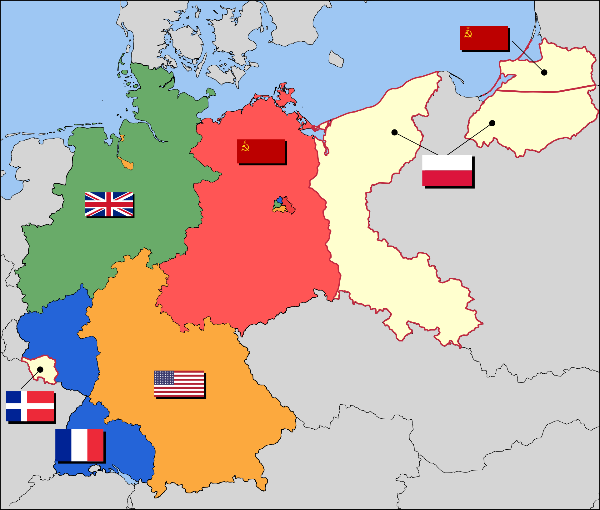
Map of the Partition of Germany following the end of WWII

Context:

Following WWII Germany lost its ability to manage its own affairs. In the west Britain, France, and the United States were the occupiers; while the state of Saarland, under French pressure and influence became an independent territory. In the East the Soviet Union became the main occupation force. Due to Soviets taking large portions of Polish territory in the east, much of what was eastern Germany, those areas East of the Oder River, was awared to Poland. The heart of the former German state of Prussia became an exclave of the Russian SSR. Millions of Germans were expelled from these areas and they were forced to move to the new German border.
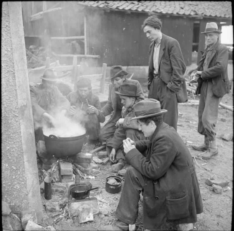
Photo of Displaced German Civilians taken by Occupying British Army

Context:

Millions of Germans were displaced due to both the destruction of cities and to the seizing of territory and the expulsion of ethnic Germans by the Soviet Union in the east.
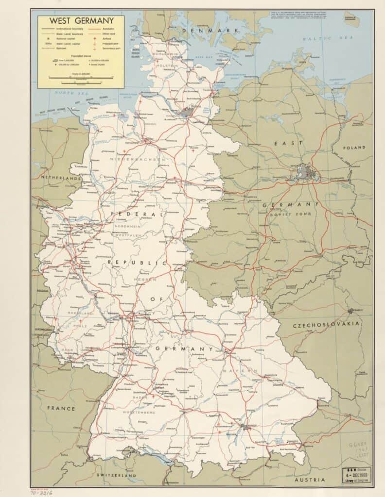
Map of West Germany 1949 – 1990
A crowd of East German refugees gathers outside the refugee center in West Berlin.

Context:

Over the course of the 41 years that Germany was divided into East and West, millions of East Germans fled from their communist government into West Germany. Following the construction of the Inner German Border and the Berlin Wall these numbers were greatly reduced. Those that did manage to escape often chose the divided capital of Berlin as the city was a bastion of Western Democracy surrounded by the communist east. If refugees could make it into West Berlin they could then be moved into Western Germany proper.

Map of East Germany 1949 – 1990
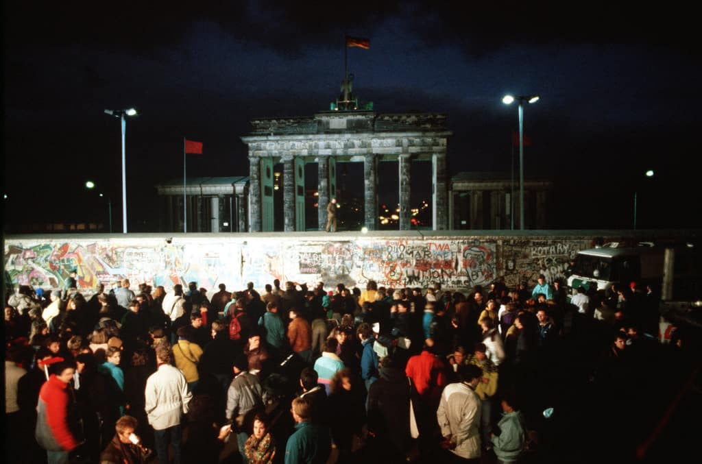
West Germans hold a vigil at the Brandenburg Gate as they anticipate demolition of this section of the Berlin Wall. A section of the Wall has already been demolished at Potsdamer Platz.

Context:

Due to years of economic stagnation and political mismanagement East Germany began to quickly crumble in 1989. A loosening of restrictions of the East German government sparked a series of events that would lead to the free movement of citizens both within the country and more importantly into the West. The Berlin Wall would eventually be opened and then torn down, becoming the precursor to reunification of East and West in 1990.
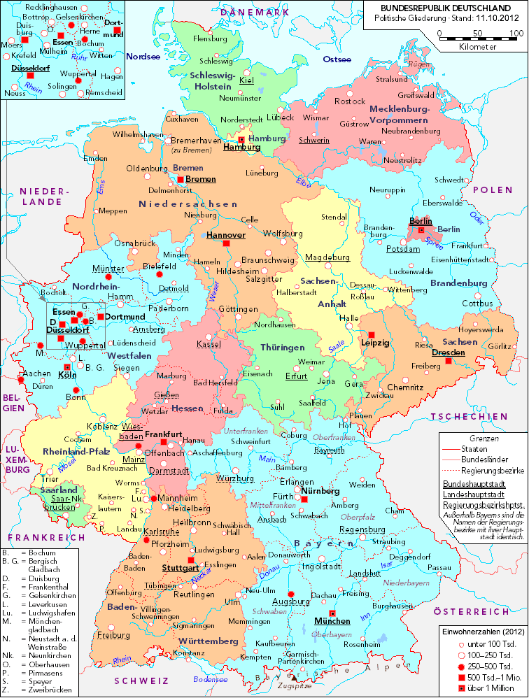
Map of Germany and her states today.

Questions:

  1. Why did Germany undergo so many changes during the 20th century?
  2. How does the first map depicting the locations of ethnic groups impact your understanding of the territorial changes that Germany experienced?
  3. Why was Germany divided following WWII? Who were the main architects of the division of Germany? What do you think happened to ethnic Germans living in areas outside of the new borders?
  4. Germany was divided into East and West for 41 years, what changes might have occurred in these two different areas during this time?
  5. Do you think reunified Germany experienced or may still be experiencing any issues from its earlier division? What might they be?

A Quagmire of the Southeast Asian Sort.

Full map of 1951 Indochina.

Questions:

  1. At first glace, what do the two maps have in common? What are some of the differences?
  2. These two maps were created roughly 20 years apart. With this information, what can we ascertain about who the intended audience for the maps are?
  3. What can these maps tell us about the scope of both the French-Indochina War and Vietnam War? Were either of these conflicts contained to their respective countries?
  4. The French-Indochina War was a war fought by Vietnamese Communists to gain independence from France after World War II. How might’ve their strongholds shown on the map above influenced the establishment of the Ho Chi Minh Trail in the subsequent decades?
  5. What role do you suppose other countries shown on these maps played in both conflicts? Use specific evidence found on the maps.
  6. From these maps, are there any other conclusions we can draw about the presence of Viet Minh Communists during the French-Indochina War and the areas that were receiving arms, supplies, and personnel from North Vietnam during the U.S.’s engagement during the Vietnam War?

Featured image found on PICRYL.

Youth and Labor in the United States

Featured image by The New York Public Library.

As industrialization in the United States increased following the Civil War, it was common to find American children working outside of the home to earn wages for themselves or their families. Children worked in many different industries and represented much of the labor force. It was not until the 1930s that Child Labor laws would be enacted to protect the rights of young children in the US.

The Breaker Boys

The young boys in this image (courtesy of LOC) worked in coal mines in Kingston, Pennsylvania circa 1900.

The boys in the photo above are one example of popular employment for youth. These “breaker boys” spent their days sitting along a conveyor belt, “breaking” away the impurities within the coal atop the belt. Working within a coal mine was often dangerous and attributed to poor health of the workers.

What do you think it was like to work as a “breaker boy”?

Child Labor Standards

An advertisement by the US Department of Labor. Image courtesy of Records of Rights.

Beginning in the 1900s, groups of people started advocating for an end to child labor. Eventually, the Children’s Bureau enacted the Fair Labor Standards Act, making it illegal for children under the age of 16 to work full time.

What do you think drove the Children’s Bureau to make this decision?

What caused the shift from supporting child labor to advocating for education?

Unexpected Impacts

Image courtesy of LOC.

What can these newspaper articles tell us about some of the outcomes of this decision?

Discussion Questions:
1. How has the United States coped with these impacts?
2. How has the United States evolved since this time?
3. What changes, if any, have been made to the child labor laws?

It’s been 99 years, Pandemics still aren’t fun.

Spanish Flu Poster. (1918) Source.
The Flu is known to have Originated in Kansas. Why has it been called the ‘Spanish Flu’?
Now this looks familiar. Cheesecloth may not have been as effective as the masks we wear in 2021, but they were just as crucial. In what ways are masks, then and now, significant? (Think medically AND culturally.)
Some Rules and Regulations from 1918 on how to stay safe during a pandemic. Notice the singular gender pronoun used in the last sentence.
Theater in 1918 compared with Theater in 2020

Possible Questions Raised by Comparison:

  1. What are some similarities in the way Americans responded to the Pandemics of 1918, and 2020?
  2. How quickly did public places reopen after the 1918 pandemic?
  3. What did the aftermath of the 1918 pandemic look like?
  4. What can we learn from the societal response to the 1918 pandemic?
Physicians vaccinating each other. (1919). Source.
This photograph depicts doctors wearing masks as they receive their vaccine. What is the message this photo is sending to the public?
This doctor looks directly at the camera as he applies the shot. During the ‘Spanish Flu’ epidemic, there were anti-maskers and anti-vaxxers, just as there are during the Covid-19 pandemic.
Note the race and gender of each doctor.